


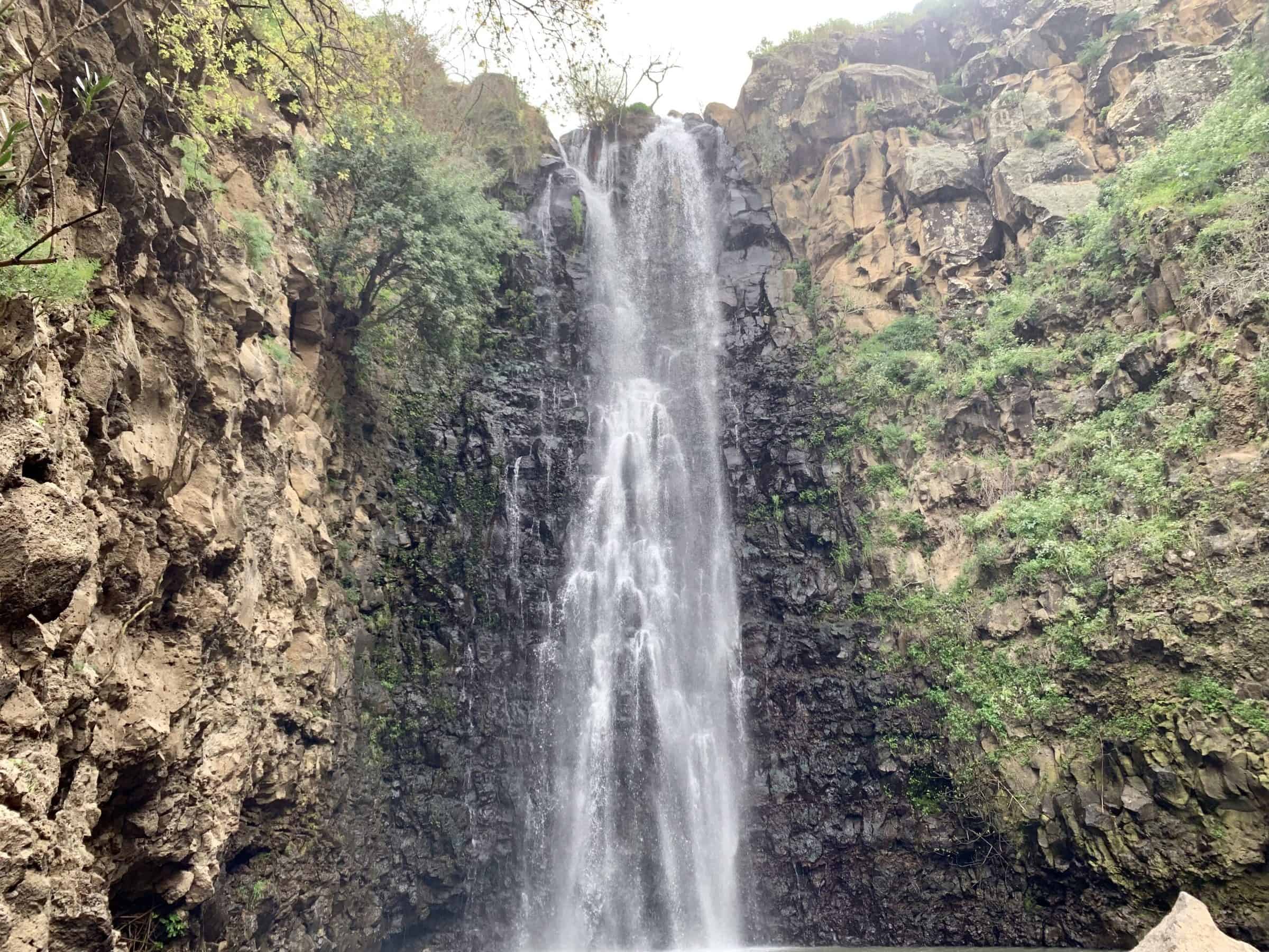
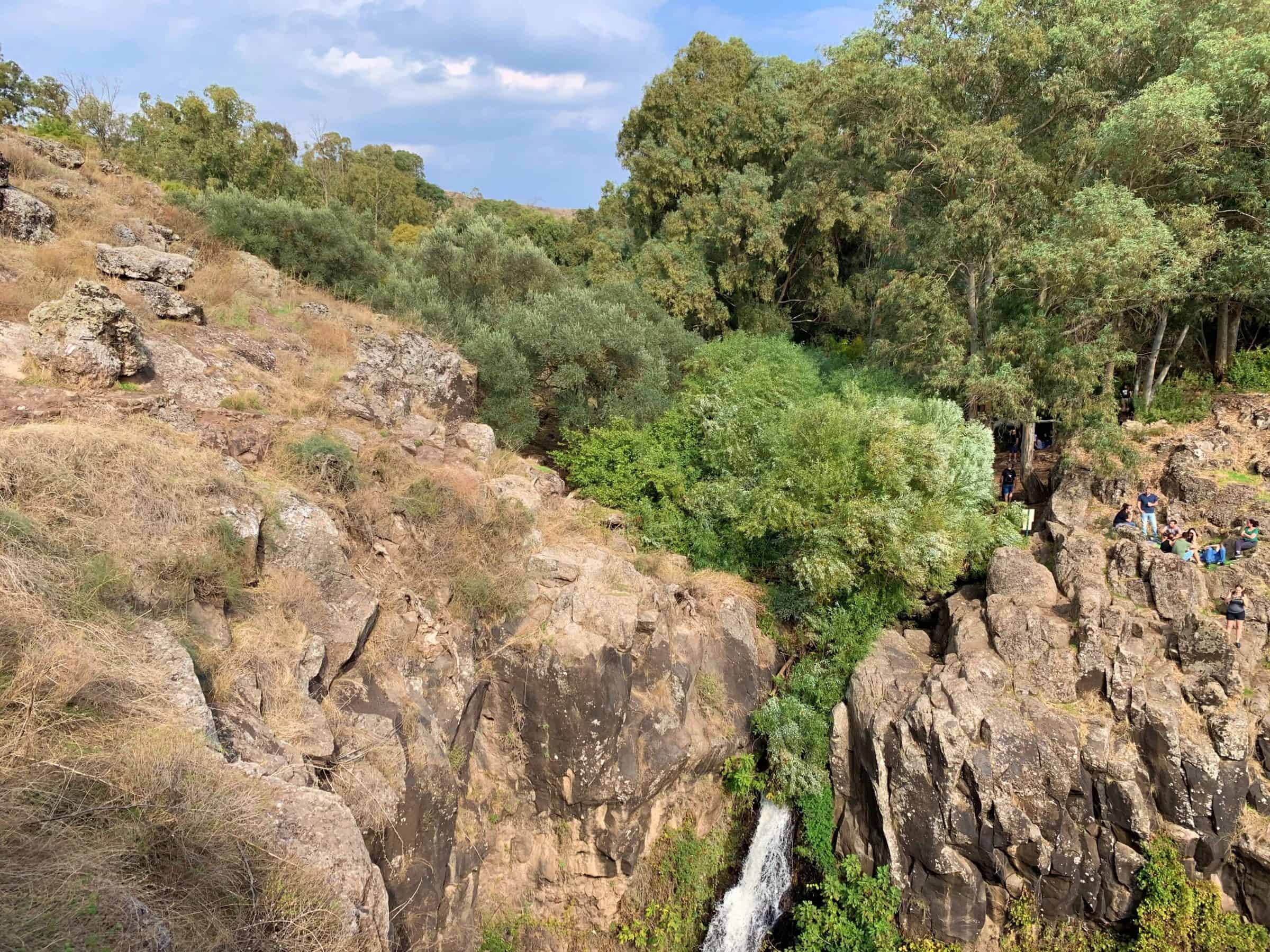

Background: This riverbed is popularly referred to by hikers as “The Jilabun,” which derives from the riverbed’s Arabic name of Wadi Jalabina (its official Hebrew name is Nachal Devora). It is part of a nature reserve in the central Golan, and has two waterfalls: the Devora Waterfall, which falls from a height of 10 meters, and the Gilbon Waterfall, which is 42 meters high (the second-highest perennially-flowing waterfall in Israel, after the Gamla Waterfall). The drainage area of the riverbed begins in the north at the foot of the Avital and Shifon volcanoes, where two shallow ravines form and then merge into one; the riverbed ends in the Jordan River, at the Pkak Bridge. The Devora Riverbed and Waterfall are named for the ancient Jewish village from the Talmudic Period, located just north of the riverbed. Among the village ruins, a stone was found in one of the walls, engraved with a large bird of prey alongside two fish. A number of ancient inscriptions were found, including one engraved on a lintel stone that states: “This is the Study Hall of Rabbi Elazar HaKappar” (this stone can be seen today in the Golan Antiquities Museum in Katzrin). At the edge of the village is an ancient olive press; olive oil production was one of the major sources of income of the residents of the village and the Golan.
About the hike: The trailhead is located at the red-colored trail that is under the eucalyptus trees next to the ruins of the abandoned Syrian village of Awinat el-Shamaliya. The path goes in between the village houses and descends by steps – also among eucalyptus trees – to the riverbed, and then to the northern bank of the ravine. The path continues until a beautiful lookout over the Devora Waterfall. Afterwards there is a fork in the path.
The blue-colored trail leads to the ruins of the Arab village of Dabura, built on top of the Jewish village from the Talmudic Period. It’s possible to visit the village, and then return to the red-colored trail.
Continue carefully down the path, cross the riverbed, and continue onward until you reach the lookout over the Jilabun Waterfall.
After this lookout, continue on the red trail; on the way you will pass a sign on your left pointing to ascending steps (we’ll return to those steps later). Descend to the water, go through bushes and skip from rock to rock, until you get to the big pool underneath the impressive waterfall. When you finish swimming, you can return to the steps mentioned beforehand. Ascend the blue trail to a parking lot, and then return to your car by walking another kilometer on a dirt road.
For the long hike: continue from the big pool on the red trail, all the way until the Ein Jilabun spring – a quaint Syrian officers’ pool in the shade of eucalyptus trees. From the pool, descend through the bushes and trees on the trail, pass an old flour mill, and then continue through fields and on dirt paths until you get to the Pkak Bridge on Road 918. Here you can meet the car you left before the hike; or you can hitchhike onwards.
Warning: Swimming is at the sole risk of the swimmers themselves.
*Do not cross any fences due to various minefields in the area.
*Do not drink the water in the riverbed.
*Do not light any fires in the nature reserve.
*Do not stay overnight in the nature reserve.
*Have shoes compatible for walking through water.
*Walk on the marked hiking trails only.
*Throw away all trash in the designated trash bins on the way.


Link to Website/Facebook Page