


The hike: There are two hiking options in the Orvim Riverbed (known in Hebrew as Nachal Orvim). The first option is an hour-long hike, from the road to the waterfall lookout and back. This is especially recommended a few days after a strong rainfall, when the ground is already dry. The second option is for serious hikers, which begins at the road and ends at the bottom in the Hula Valley near Kibbutz Gonen. This takes at least 3 hours. (As of now, this path has been closed due to an avalanche.)
As you begin to walk on the red trail, you will cross a shallow ravine and soon will be on the right side of the riverbed. 500 meters later, you will arrive at a breathtaking lookout of the waterfall and the northern cliff of the riverbed. Here, there’s a good chance you’ll see some birds of prey, who often use the cliff for overnight rest.
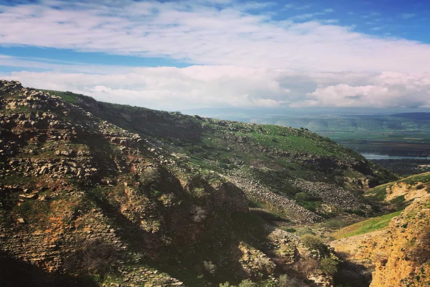
On the southern side of the riverbed is another impressive cliff, carved out of the layers of basalt rock. This rock layer covers the entire central Golan, and is known as “Dalleway Basalt.” This layer began as a lava flow from the depths of the earth approximately 1.7 million years ago, and continued for about another million years.
The Orvim Waterfall is one of the most impressive of the Golan waterfalls, although it does not often flow with water. Like all the other waterfalls of the northern Golan, it only flows in winter.
If you are doing the short hike, from this point you return to the parking lot. If you are doing the longer hike, you can descend on the trail to the bottom of the waterfall, and see the layer of limestone that is visible beneath the basalt. From the bottom of the falls, you can walk along the wall until you find an easy descent, and then cross the ravine coming from the south, and continue down the riverbed, while crossing on the path from side to side.
After about 15 minutes of walking, you will reach a series of four small waterfalls, at a height of between 2 and 6 meters. The fifth waterfall is the last one, at a height of 20 meters. But no worries: the path goes above the waterfalls and there’s no need to jump or descend down the falls.
Continue south on the path until you reach Road 959, approximately 1.5 kilometers from Kibbutz Gonen. Here you hopefully left a second car before you began the hike…
From more information on the route (with a map), please click here.


Link to Website/Facebook Page