Background: Mt. Bental stands at an altitude of 1165 meters above sea level. It’s one of the ash cones that makes up the Golan’s “Volcano Line,” which is a chain of volcanoes that stands at the border between Israel and Syria.
The mountain is built out of touf and basalt. When the ancient volcanic eruptions were taking place in the Golan, the “chimney” of the volcano was clogged, and the lava had to find another exit; instead of erupting from the mountain’s peak, it erupted from the western slope of the mountain.
At the foot of Mt. Bental – and in its crater – is Kibbutz Merom Golan, the first of all the modern Jewish villages founded in the Golan. After the 1967 Six-Day War, the kibbutz founders were located at the edge of the Syrian village of Kuneitra, which had been abandoned by its residents. In 1972, the kibbutz members moved to their permanent site: the western side of Mt. Bental.
The name: The source of the mountain’s Hebrew name is the difference in height between it and its taller neighboring volcano to the south, Mt. Avital (altitude of 1204 meters above sea level). In other words, Avital – “the father of dew,” is higher than Bental – “the son of dew.” In Arabic, Mt. Bental is known as “Tel el-Gharam,” which means “the hill of the beloved,” or “the hill of the intense love.”
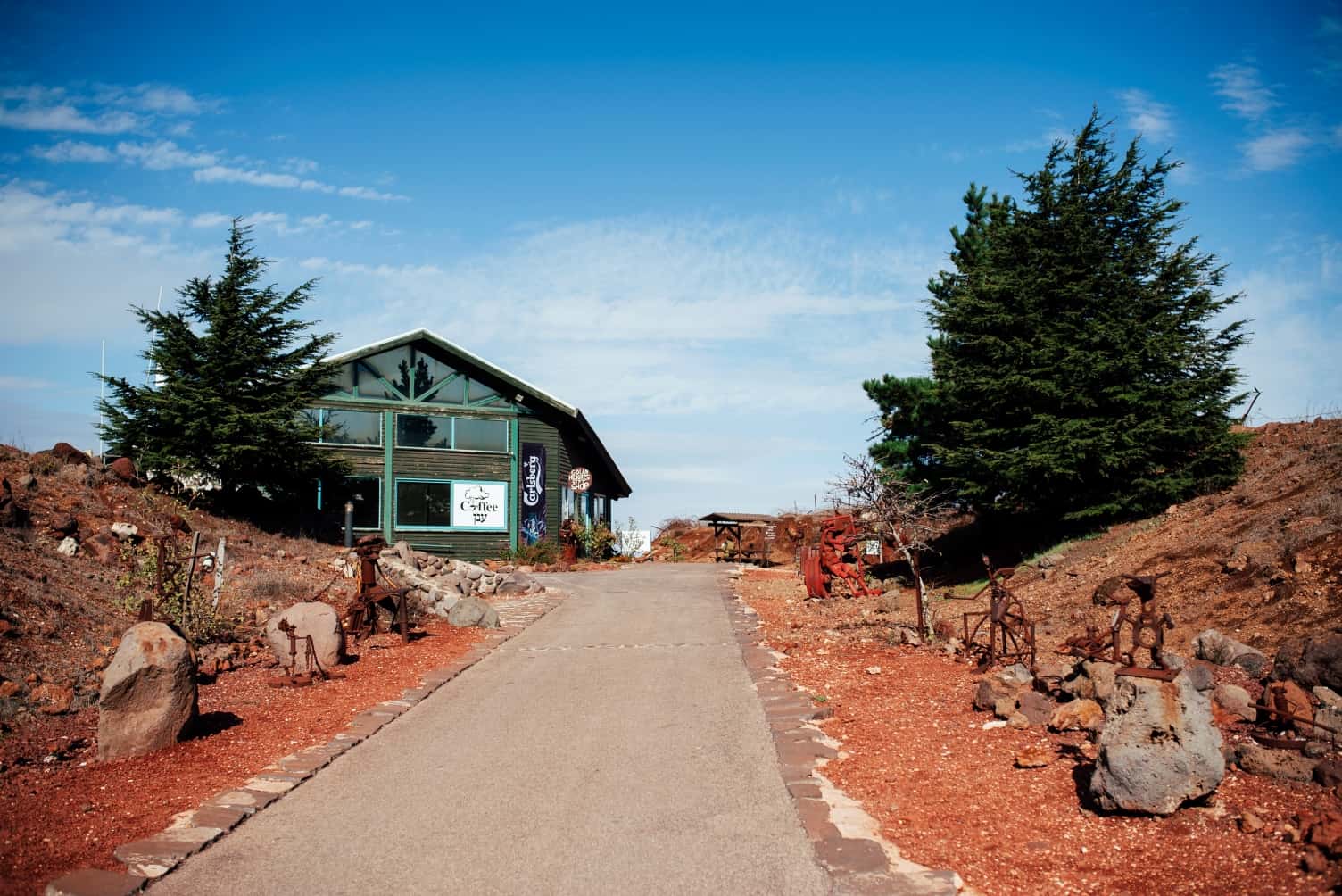
On the peak: The walkway from the parking lot to the peak is decorated by iron sculptures crafted by the Dutch-born Joop de Jung, who is a member of Kibbutz Merom Golan. On the peak is the Coffee Anan café, and near it is an unmanned emergency IDF base, which was built on a Syrian base that was here before it. You can walk around the site, and go into the trenches, too.
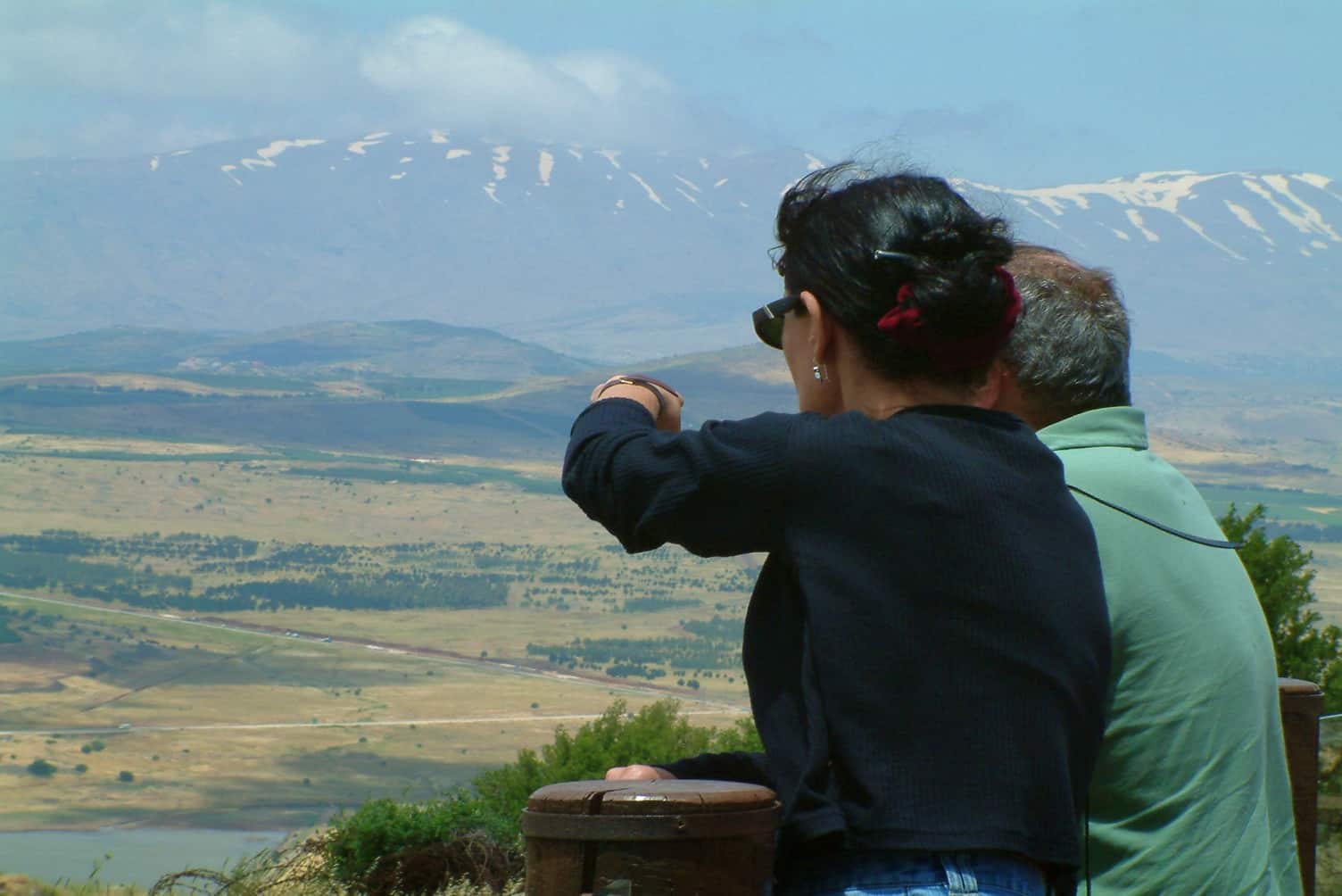
From the peak is a great view of 360 degrees.
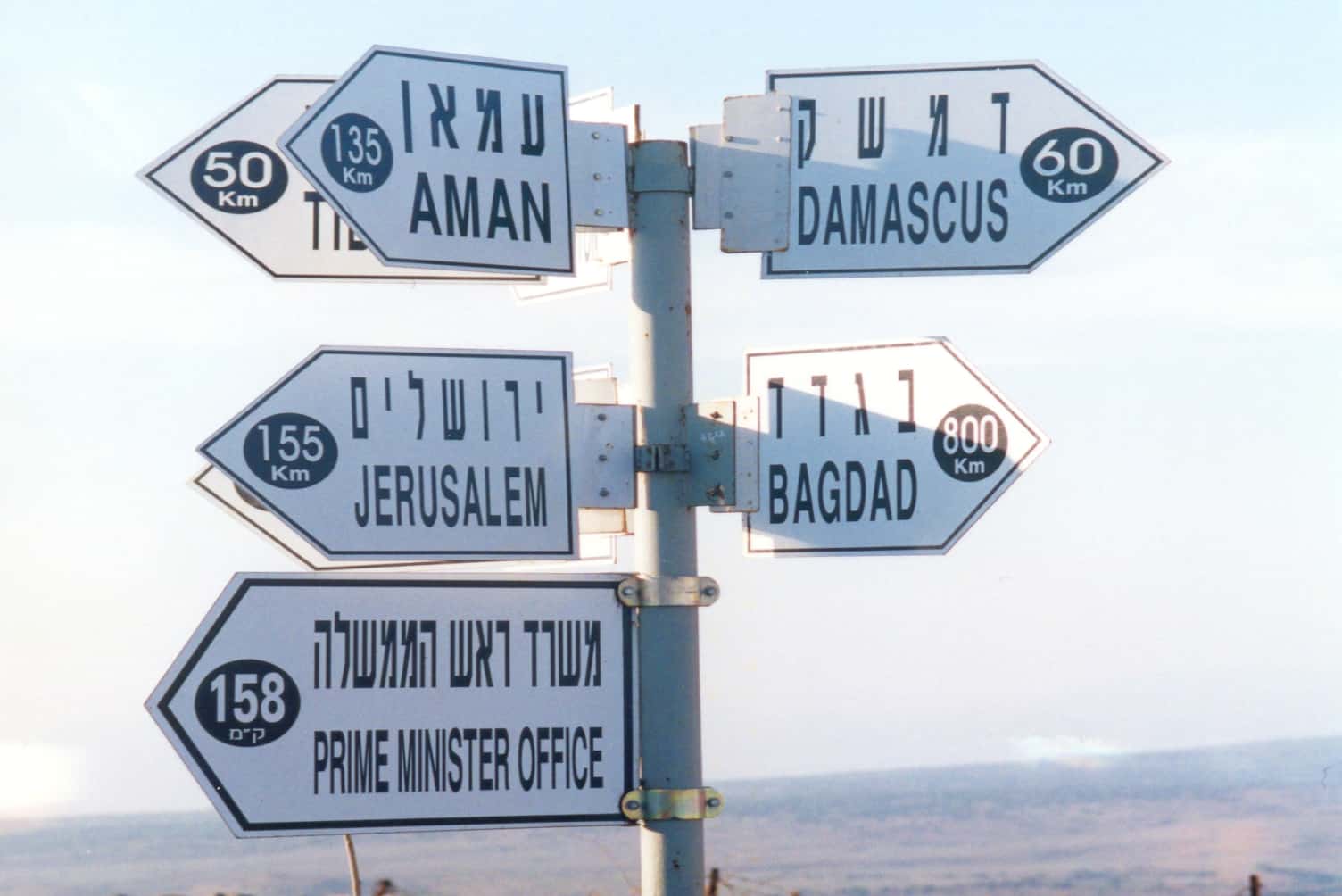
To the east: the border with Syria, and deep inside Syria itself. Notice the white buildings of the nearby UN base that sits literally on the border between the two countries. To the north: the northern Golan and Mt. Hermon. Underneath us are two reservoirs – Merom Golan Reservoir and Bar-On Reservoir; these provide water for irrigation of the agricultural fields nearby. You can also see Mt. Odem and the Odem Forest. If you look to the west, you can see the Ramim Mountain Range, and Kiryat Shmonah.
There’s a hiking trail marked in red that descends from Mt. Bental towards the kibbutz and the reservoir. The Golan Trail is marked in green, white, and blue, and is located below us. Enjoy!